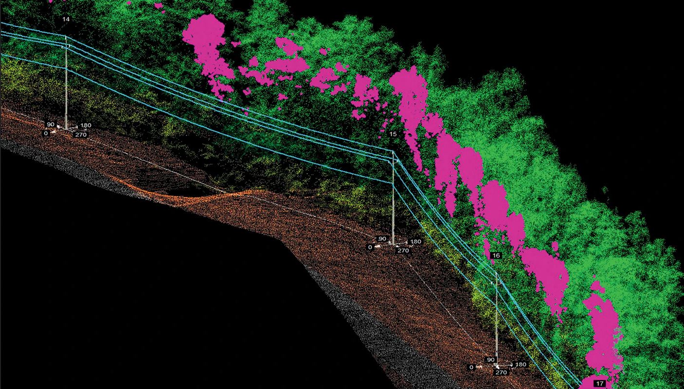
Mid-South Synergy utilizes unmanned aerial vehicles to identify clearance violations and hazard trees.
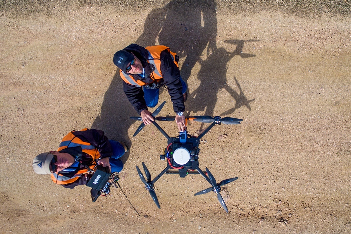
Pilots with Texas Drone Professionals prepare their aircraft and its LiDAR sensors for a flight along Pedernales EC power lines.
I wanted to give my perspective on UAV LiDAR in the industries we serve, as well as explain my thoughts on using a service provider vs. an in-house program for data collection.